


Our PembiaValleyOnline Rainwatchers are reporting this morning much needed rain, and a few thunderstorms, arrived in the region Tuesday afternoon and evening. After a stretch of well above temperatures nearing 30 degrees, and gusty southerly winds up to 60 km/h, conditions had dried out considerably over the past week, or so.
"Since about May 22nd, except for one day following a cold front, temperatures across the region have consistently been in the 29 to 31 range, with breezy conditions due to the pressure gradient (the difference in pressure) between a blocking high to our east and a consistent train of low pressure systems moving through," explained CMOS Accredited Weathercaster Chris Sumner. "Tuesday was the start of less windier conditions, but the general pattern for the remainder of the week will remain above average for this time of year."
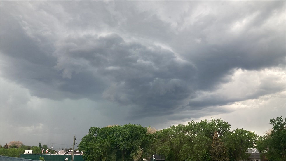
Severe Thunderstorm Warnings were in place for parts of the Pembina and Red River Valleys Tuesday afternoon and evening, including the Municipality's of Lorne, Louise, Pembina and R.M. of Stanley. Those were issued after strong to severe thunderstorms began bubbling up along a trough of low pressure swinging through the province mid to late afternoon.
"Those storms weakened, and dissipated, by mid-evening, but some areas did see some decent rainfall from them," noted Sumner. "In fact, a Tornado Warning was briefly in effect shortly after 4 p.m. for the R.M. of Brokenhead, which includes Beausejour. That was based on strong rotation noted in a particular thunderstorm cell. That same storm also dropped nearly two inches of rain (almost 50mm) in that community in a short period of time."
The following totals are courtesy of our PembinaValleyOnline Rainwatchers, Environment Canada and the Manitoba Ag Weather Network:
Reinland - 32mm (about 1.25 inches)
Gnadenthal - 30mm (1.2 inches)
Horndean (north of) - 20mm (8/10th)
Manitou - 13.2mm
Woodmore - 12.5mm (1/2 inch)
Elm Creek - 11.9mm
Morris - 8.5mm
Altona (in town) - 8mm
Plum Coulee - 7.1mm
Dominion City - 5.4mm
Carman - 5.2mm (about 2/10)
Winkler (south of city) - 4.5mm
Steinbach 2.7mm
Pilot Mound - 2.4mm (almost 1/10)
Morden (in city) - 2.1mm
Gretna - 1.5mm
Emerson - 1.3mm
Two miles south of Morden, a trace of rain
25mm = 1 inch
A relatively quiet Wednesday is expected, with mainly sunny conditions and highs around 28, but Sumner noted warmer weather, and additional thunderstorm chances, return Thursday and beyond.
"Upper level ridging returns to the eastern Prairies by Thursday, with surface high pressure in place, which means a lot of sunshine and temperatures remaining close to 30 most days," he said. "The southwesterly flow aloft also means moisture being pumped into the region from the southern U.S., and that means we'll see the humidity creeping up for the end of the week, and weekend, leading to muggy conditions, at times. That factor, along with daytime heating, means there will be thunderstorm chances most afternoons/evenings Thursday through Saturday, but with high pressure in place, we're missing a trigger to fire them up. I don't expect widespread chances of thunderstorms, and any that do develop, will be localized."
Sumner added widespread severe weather is not expected in the coming days, but depending on the circumstances surrounding any particular storm that develops, it could reach strong to severe limits, but again, would not be widespread in nature.
Averages as we head into June are 23 degrees daytime and 10 degrees overnight.


 Thu, Apr 25, 3:00 PM
 Agriculture, Manufacturing, Professionals, Skilled Trades, Full-time, Permanent
 Featured


