


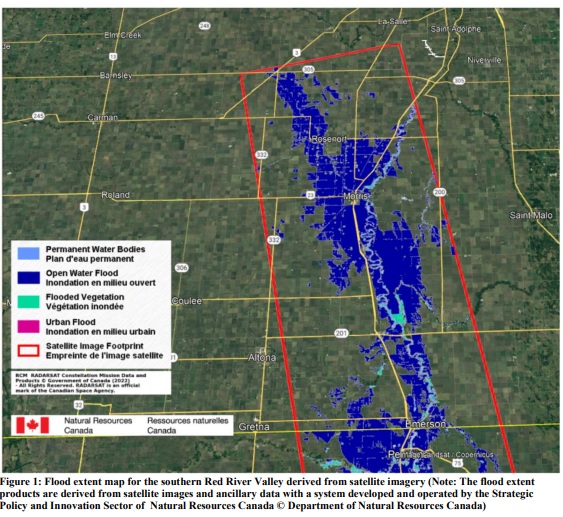
According to the Manitoba Hydrologic Forecast Centre’s latest report issued Sunday afternoon, the Red River is near crest at Emerson, at levels similar to 2009. Locations throughout the Red River valley are expected to peak between today and Saturday, at levels between 2011 and 2009 spring flood levels.
Meanwhile, a wave action scenario similar to Saturday is expected to play out Monday with strong southerly winds gusting to 80 km per hour. These winds could cause water levels in flooded areas from Letellier to Rosenort to rise by up to six inches. Wave action could also add to the temporary increase in water levels and could result in temporary over-topping of roads.
Drains, creeks, and tributaries in the Red River basin are at or above capacity but water levels have stabilized or are declining in most of the tributaries. Water levels on the Red River main stem continue to increase as water moves through the system. Water levels across the Red River basin are expected to remain high for an extended duration.
A flood warning remains for the Pembina River in Manitoba. Water levels remain high, and are over channel capacities at some areas, but water levels are declining.


 Thu, May 2, 8:24 AM
 Full-time, Labour
 Featured


