


"It was a brutal weekend with brutal weather," said Dave Carlson, Reeve for the Rural Municipality of Emerson-Franklin. 
Fortunately, Carlson says his municipality didn't get hit as hard as those to the west.
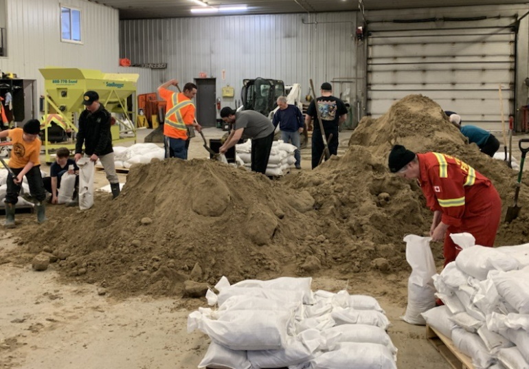
"We did get a lot of rain and some overland flood," he explained. "We currently have about eight road closures, we had to make some sandbags for a couple of residences in the northeastern part of our municipality. That was handled and now it's just waiting for all of this water to go down and see what kind of damage is left behind on some of our roads."
Meantime, Carlson is keeping an eye on how much water is yet to arrive in Emerson-Franklin from the United States via the Red and Roseau rivers.
According to the Maniotba Hydrologic Forecast Centre's latest flood outlook, the Red River is expected to crest once again at Emerson between 787.5 - 789.8 feet around May 2-6. That's four to six feet above channel capacity, but still about six feet below the community's dike elevation.
"We'll probably be making a few sandbags for some trouble spots, helping anyone that needs to close a ring dike around a residence," explained Carlson. "Fortunately, our larger communities like Emerson and Dominion City are ring diked, and most of our area is flood-proofed to 1997 levels plus two feet. Everyone should make out alright, but it'll be a real nuisance though. There will be some localized flooding for sure."
Since Sunday, the Roseau River has gone up four inches at Gardenton to 965.30 feet, and one inch at Stuartburn to 949.26 feet.
"I'm thinking it should be alright for the most part," added Carlson. "The Roseau River is a little higher as you come out of the Valley so there's usually not as many issues. but it's the overland flooding that we're mostly concerned with because all of that water has to hit the river channel. Typically, when the Red gets really high, the Roseau will back up somewhat. I'm also not sure how much snowfall Minnesota got, and that's where that river melt is from."


 Sat, May 4, 7:30 PM
 Full-time, Term, Education
 Featured


